Development Proposal Segments

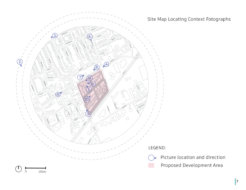
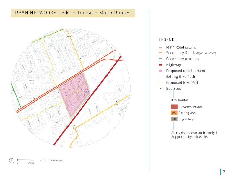
For this collaboration, I developed a context photo map with photographs of existing conditions and surrounding areas, and a site map locating those context photographs and their orientation.


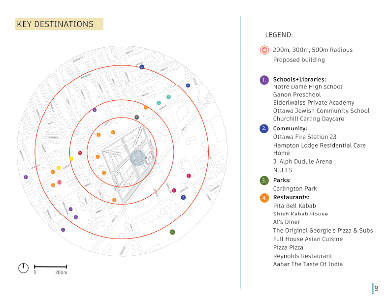
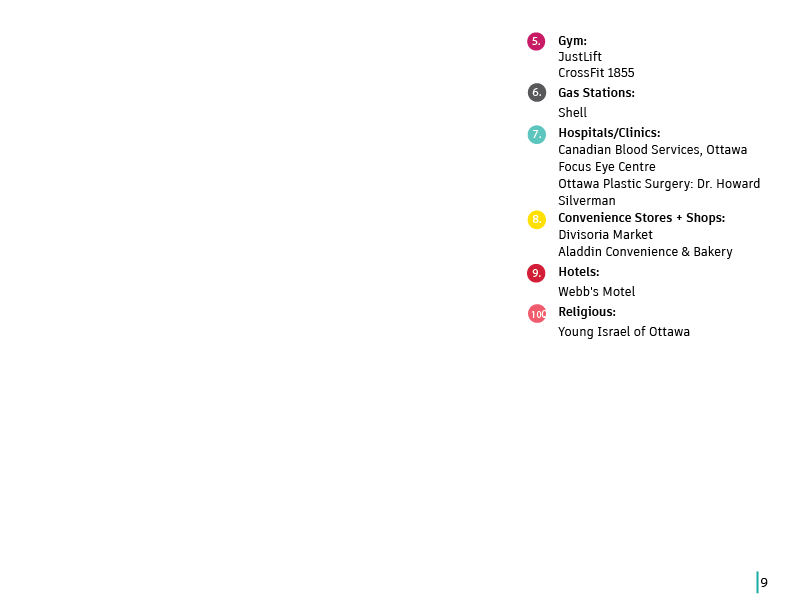
I developed a key destinations map within a 200m, 300m, and 500m radius that highlighted schools + libraries, community buildings, parks, restaurants, gyms, gas stations, hospitals/clinics, convenience stores + shops, hotels and religious hubs.


I made a community design plan that noted high-rise office areas, low-rise residential areas, low-rise mixed-use and the proposed mid-rise mixed-use area.
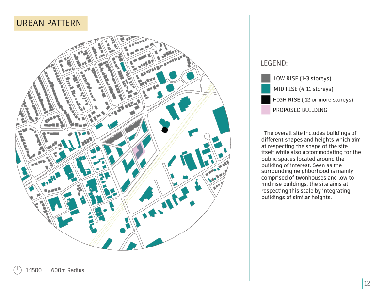
I continued with an Urban pattern map that located the proposed building within the site map. It showed high-rise buildings of 12 or more storeys, mid-rise buildings of 4-11 storeys, and existing low-rise of 1-3 levels.

The last map I developed for the project was an Urban Networks Map noting existing arterial, major collectors, collectors and highways in relation to the proposed development. The map also showed the site's proposed bike path connecting with the existing one and bus stops and existing public transit routes.

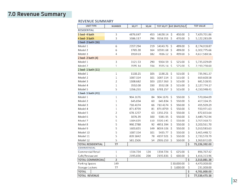
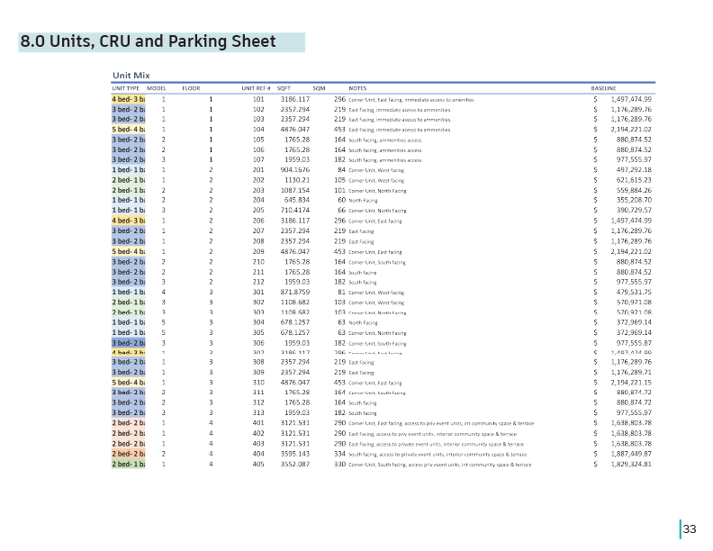
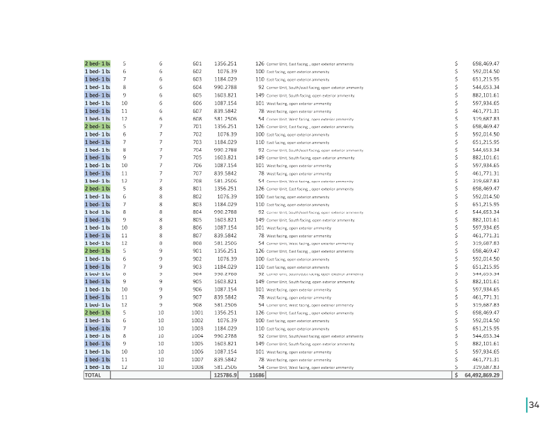
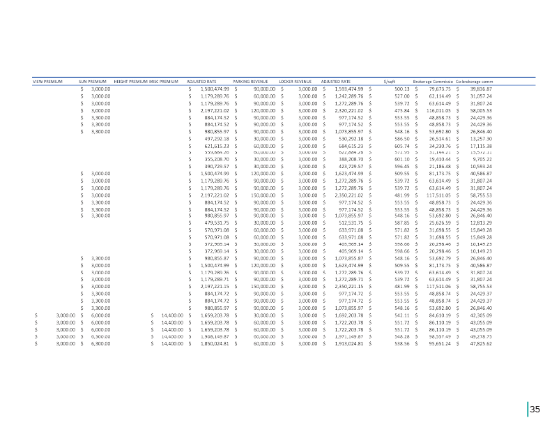
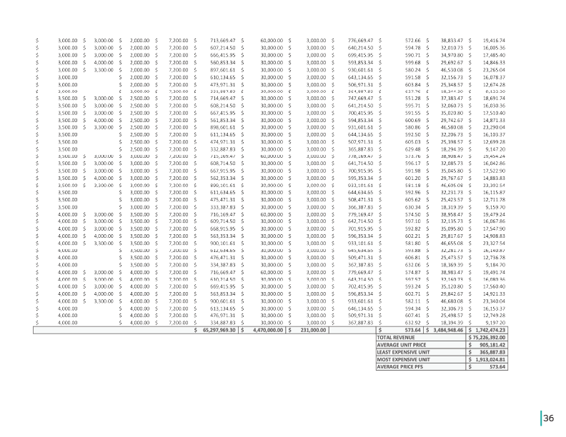
Additionally, I developed a revenue summary, unit mix, CRU, and parking sheet based on the units designed by Anissa and Luis and real estate market research.


